It’s impossible to capture Argentina in brief, but here are a few snapshots so you can start to get the picture:
Los Glaciares National Park
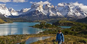
Parque Nacional Los Glaciares stretches north to south for about 200 kilometers (124 miles) along the eastern edge of the huge Hielo Sur, or southern continental ice sheet. Considered the largest wilderness tract in Argentina, the park was created in 1937 to protect a unique landscape formed by glaciation. In 1982, Los Glaciares was declared a UNESCO World Heritage Site. The park is located between the 48th and 51st parallels south (by comparison, the U.S.-Canadian border runs along the 49th parallel north over Montana). More than a dozen large glaciers flow down off the Hielo Sur into Lago Viedma and Lago Argentino, two large glacial lakes at the base of the mountains. About a quarter of the park is covered in ice—1,000 square miles—and the remaining area includes lakes, steppe, forest, and highland semi-desert.
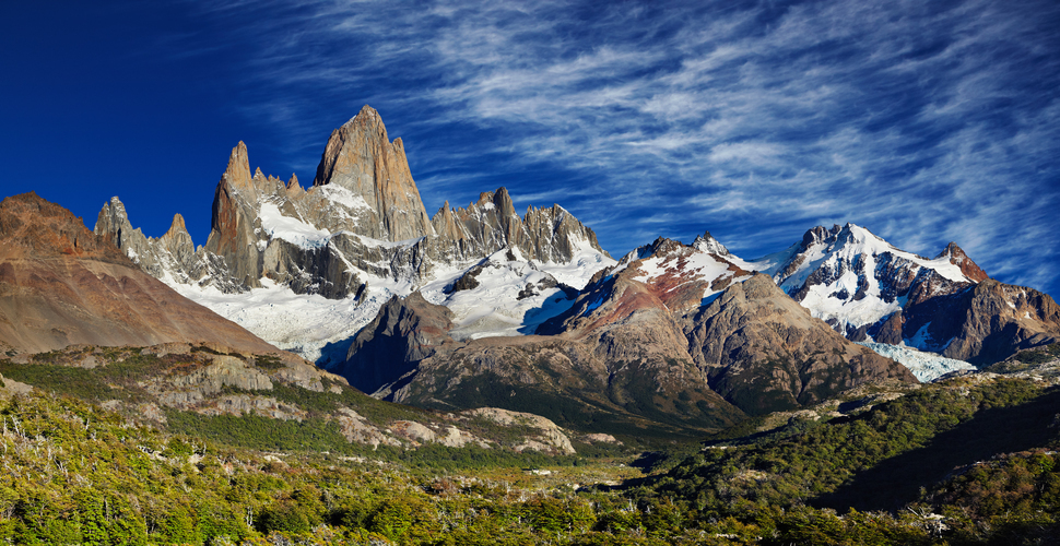
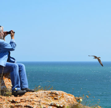
As you can imagine, hiking in Los Glaciares is an unforgettable and spectacular experience. This is surely one of the most dramatic and scenic areas of the Andes, dominated by Cerro Torre and Monte Fitz Roy. While the two mountains are not particularly high in elevation—Cerro Torre at 3,128 meters (10,262 feet) and Monte Fitz Roy at 3,440 meters (11,286 feet)—their dramatic granite spires call out to adventurers and photographers from all over the world. Wildlife watching and birding can be quite productive if you keep your eyes open! Bird species present include Andean condors, rheas, black-necked swans, and Magellanic woodpeckers.
Mount Fitz Roy
The Tehuelche Tribes revered Monte Fitz Roy, calling it “El Chaltén,” the peak of fire, because it always seemed to be smoking. In fact, the mountain was considered to be a volcano for years until it was determined that the “smoke” was a cloud of mist that hovered over the peak. Francisco Perito Moreno gave Fitz Roy its current name, after Captain Fitzroy of the Beagle, who accompanied Charles Darwin up the Rio Santa Cruz to within 50 kilometers of the Andes in 1834. These two explorers were presumably the first Europeans to view the peak. You don’t have to be a mountaineer to see and experience Fitz Roy, as a number of terrific day-hiking trails can be found right from the town of El Chalten.
Perito Moreno Glacier
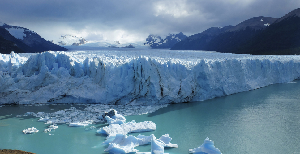
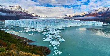
Perito Moreno Glacier is 18.5 miles long and three miles wide. Located in Los Glaciares National Park, it’s one of the few glaciers in the world said to be still growing, and is one of the world’s most active glaciers. Each day Perito Moreno calves thousands of tons of blue ice from its 180-foot-high face into the lake, an act that brings the natural masterpiece to life.
To just talk about the glacier doesn’t do it justice. You need to see it, feel it, hear it, and breathe it in up close to appreciate its enormity. There are a few different ways to see and experience Perito Moreno. You can take a boat tour, which gets you right up to the leading edge of the glacier where, if your timing is right, you can witness the glacier calving—shedding building-sized chunks into the lake. If you don’t want to take the boat, a boardwalk has been built that lets you walk through some of the prettiest parts of the park, with great views of the glacier along the way. For the ultimate way to see Perito Moreno, strap on crampons and follow a guide onto the glacier. The topography is surreal, like a mash of mini mountain ranges pocked by lagoons and crevasses.
Mendoza Wine Region
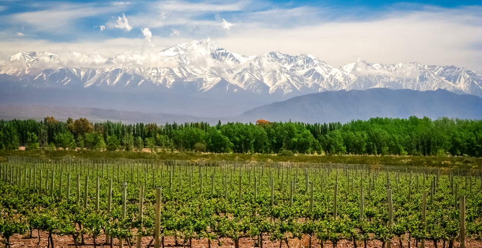
Mendoza, the capital city of Mendoza Province, lies at the heart of the Cuyo Region, which sits on the eastern slope of the Andes. The region around Mendoza is the largest wine-producing area in Latin America, home to over 1,000 wineries.
The town is picturesque and charming, with tree-lined streets, a spacious and beautiful city park, wide, pedestrian-friendly sidewalks, and a white-capped Andes Mountain backdrop that complements the orderly vineyards dotting the river valley. The highest peak in the Americas, 22,841-foot Aconcagua Peak, lies 70 miles northwest of Mendoza and draws climbers from around the world.
When colonists first arrived at Mendoza in 1561, they found a series of human-constructed waterways that were used to bring water from the Mendoza River to irrigate the otherwise arid landscape. (The city receives no more than five days of rain annually.) The canals had been built by the Huarpe Indians, who along with the Puelches and Incas, had settled the area. Agricultural production increased in the 1700s, along with trade with Buenos Aires. When Italian, French, Spanish, and German immigrants came to Argentina in the 1800s they brought their native vines—which is why such diverse varieties are grown here, including Bonarda, Barbera, Sangiovese, Lambrusco Tocai Friulano, Tempranillo, Torrontes, and the region’s flagship wine, Malbec.
Bariloche
Being from Bozeman, Montana, we’re admittedly partial to ski towns—whether they’re in the Rockies or South America. San Carlos de Bariloche – or simply “Bariloche” – sits at 2,500 feet above sea level, 1,000 miles from Buenos Aires. You’ll probably be there in the Southern Hemisphere summer, but there’s lots to do other than ski. The town, which has a European ambience, was founded in 1903 as the first Patagonian “tourist town.” That comes as no surprise, given its location on the shores of Lago Nahuel Huapi, inside Argentina’s first national park of the same name. There are myriad hiking trails inside Nahuel Huapi National Park, including the Cerro Llao Llao trail, Casa de Piedra, Cerro Lopez, and Refugio Frey on Cathedral Mountain. Cerro Leon, on the eastern side of the lake, has pictographs inside the mountain and is only accessible on guided hikes, which lead through a small crack in the wall. You can also go horseback riding, tour the local museums, take a boat excursion, or ride a gondola to the top of the ski mountain for 360-degree views of the entire Lakes District, Tronador Volcano, and the high desert to the east.


